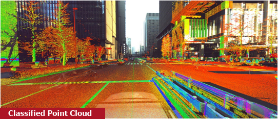
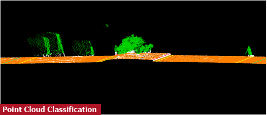
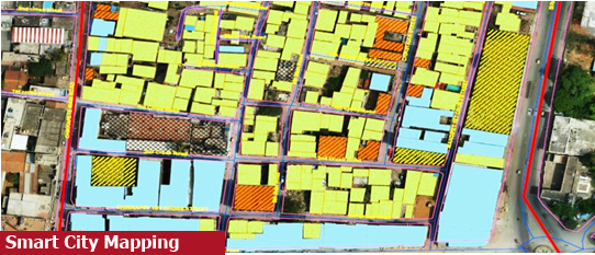
Smart City Mapping.
The scope of the project was to survey the city as part of the ABD (Area Based Development) project.
The data collected are used to prepare 3D models used for planning beautification of the city,
which can be later integrated to develop ICC.

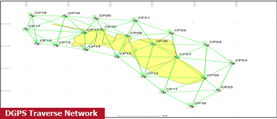
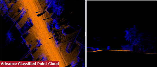
Mobile LiDAR Survey DGPS Survey

3D Map
DEM (Digital Elevation Model)
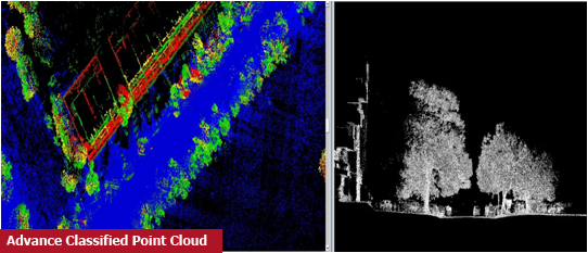
Point Cloud

Chennai, TamilNadu - 50+ sq.km, 6000+ km
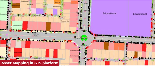
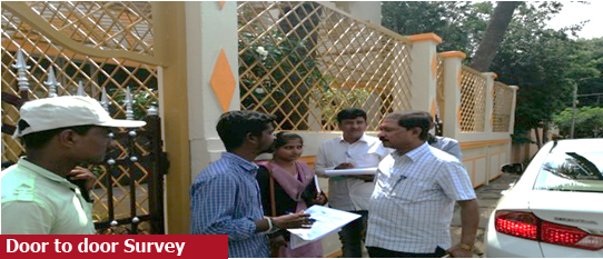
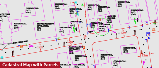
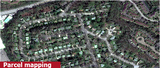
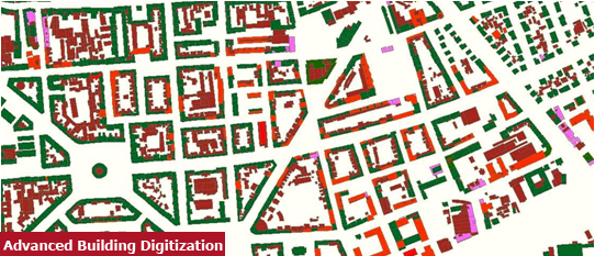
Property Text Mapping.
The scope of the project was to collect the spatial and non-spatial data of the city using Geomatics technology. SSGIS used drone based survey along with DGPS and Total station to collect the spatial data and field survey was done to collect non spatial data
Mobile LiDAR Survey DGPS Survey Door to door survey
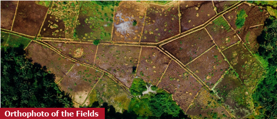
Orthophoto
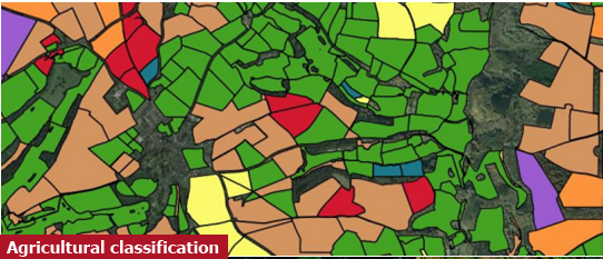
GIS Map as Shapefile
Geodatabase
Survey Report
Tumkuru, Karnataka - 10 sq.km, 300000 assessment
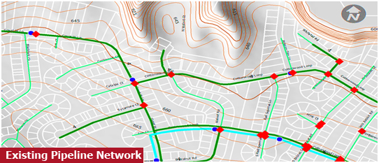
Rural Water Supply Distribution.
The scope of the project was to survey the water supply network of the areas in Tamilnadu and Karnataka. The project involved data collection of water supply accessories and customer details.
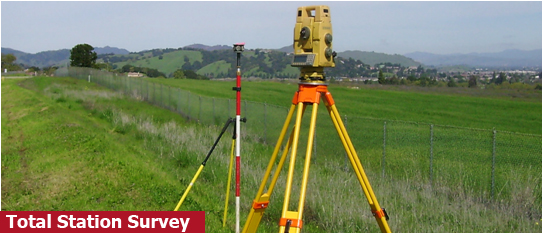
Total Station Auto level and Digital Level
CAD drawing of supply network Survey Report Topographic Map (Road corridor, Buildings etc.) Long Section and Cross Section
TamilNadu and Karnataka - 150000 km

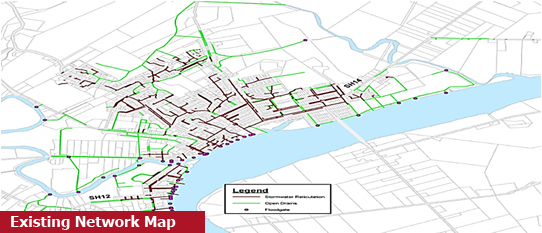
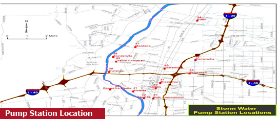
Storm water Drain .
The scope of the project was to survey the water supply network of the areas in TamilNadu and Karnataka. The project involved data collection of water supply accessories and customer details.
DGPS Survey Total Station
Topographic drawing CAD drawing of supply network Survey Report
TamilNadu – 3200 km
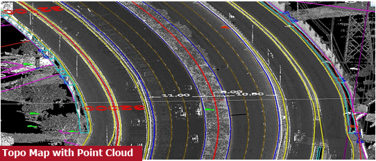
DPR for Road for NHAI .
The scope of the project was to survey the existing road using Mobile LiDAR device as part of the DPR. The data is collected to plan and design the road network for widening and other improvements by NHAI.
Mobile LiDAR Survey DGPS Survey Total Station Auto level and Digital Level
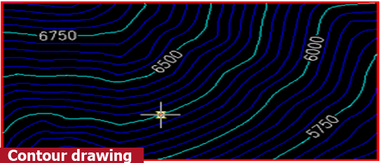
Topographic drawing Point Cloud DGPS Report DEM (Digital Elevation Model) Spot Level Contour drawing Cross Section and Long Section
5000+ Km Chennai – Salem; Madurai – Natham; Usulampatti – Theni; Rajapalayam; Delhi – Varodra; Pehowa – Naurnal; Rajoli- Pathyapur; Chattisgarh; Bathkal
Underground Sewerage Survey.
The scope of the project was to survey the manholes and other utilities related to the underground sewerage network. The GPR technique was used in few critical places for data collection. Then the utilities are mapped in CAD
DGPS Survey Total Station Auto level and Digital Level
CAD drawing of supply network Survey Report Topographic Map (Road corridor, Buildings etc.) Long Section and Cross Section
TamilNadu and Karnataka - 30000 km
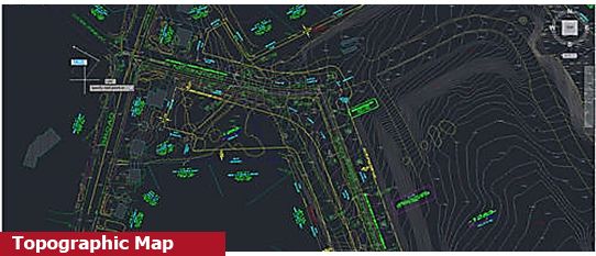
Detailed Topographic Survey City Mapping .
The scope of the project involves topographic survey using drone and map out the road network of the city. The project was carried out in the cities of Coimbatore, Madurai and Trichy.
DGPS Survey Total Station
CAD drawing Topographic Map (Road corridor, Buildings etc.) Long Section and Cross Section
TamilNadu, Karnataka, AndhraPradesh – 32000+ km
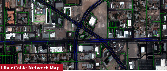
Fibre Optic Cable – Telecom, Bharatnet, Chattisgarh .
This project involves, data collection and mapping of the land parcels and customer details to lay fibre optic cables. The existing assets of the fibre optics were also captured using DGPS and mapped
DGPS Survey Total Station Drone Survey (in some places)
Orthophoto Parcel map Asset Map DGPS Report
Chhattisgarh – 6,000 km
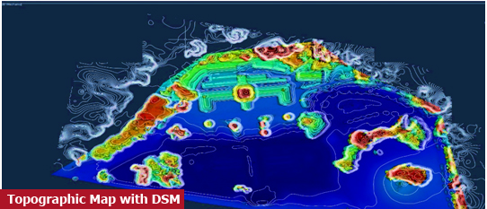
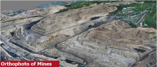
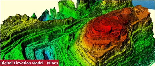
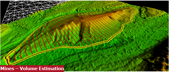
Mining Survey .
The mining survey activity involves Aerial Survey and conventional survey to identify the volume of ore in the mines area. The data is processed and volume calculation is done using Bentley’s software
DGPS Survey Total Station
Topo drawing Contour drawing DEM (Digital Elevation Model) and DSM (Digital Surface Model) Volume Report
TamilNadu – 4000+ hectare
Irrigation Survey and Mapping .
The scope of the project was to survey the irrigation area using drone and conventional method. The irrigation area is mapped in GIS platform and shared with the client
DGPS Survey Total Station
Topographic drawing DGPS Report Plot Map
TamilNadu, Karnataka – 90000 acres